An Ochre Moon publication
ConfluenceA Russell-Cuffel Family History

From the book

Maps and charts

A few of the maps and family charts drawn for the book. The book has many more, one or more in nearly every chapter.
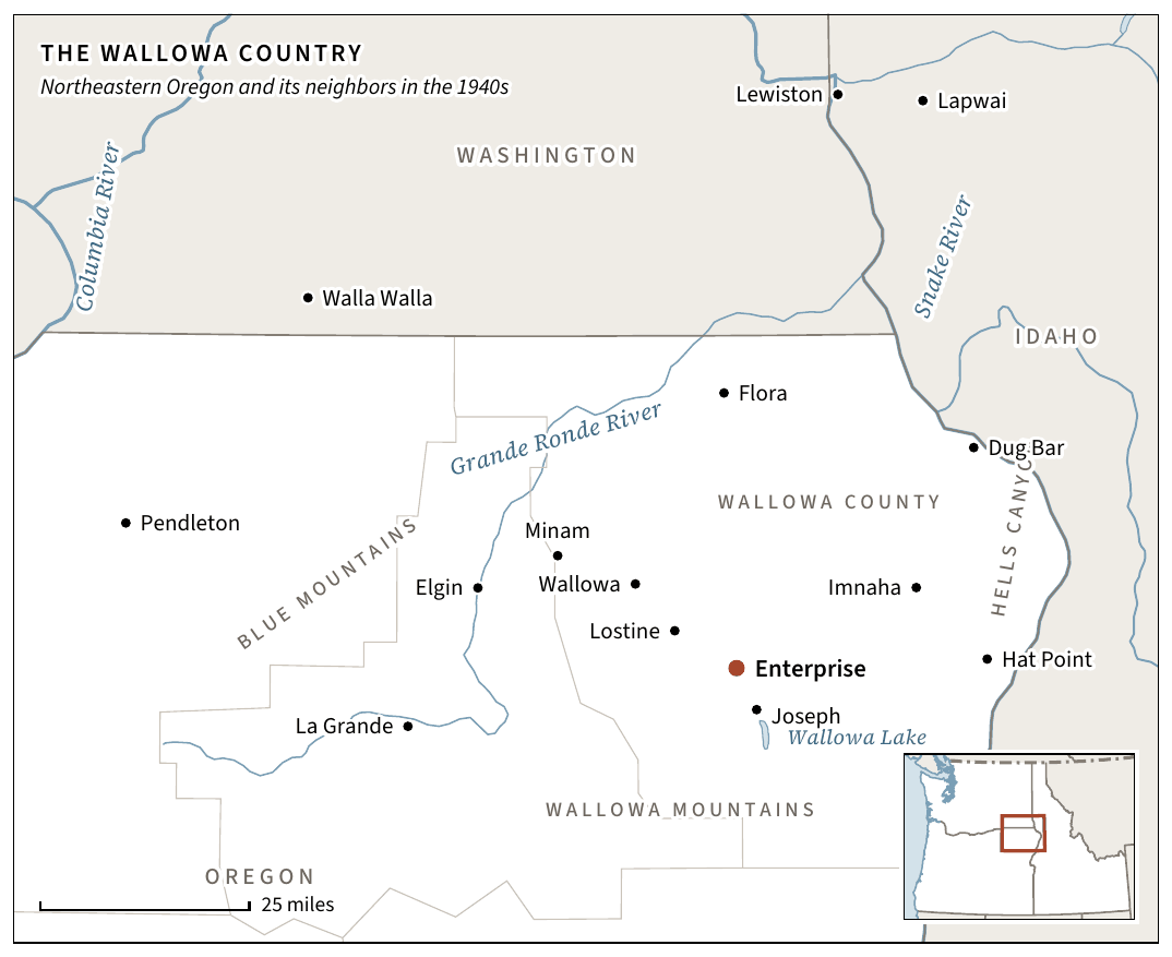
Map of the Wallowa country in northeastern Oregon, with Enterprise, Joseph, Wallowa Lake and nearby towns in Washington and Idaho.
The Wallowa country. Northeastern Oregon and its neighbours in the 1940s, with Enterprise marked. From Part One. Open full size
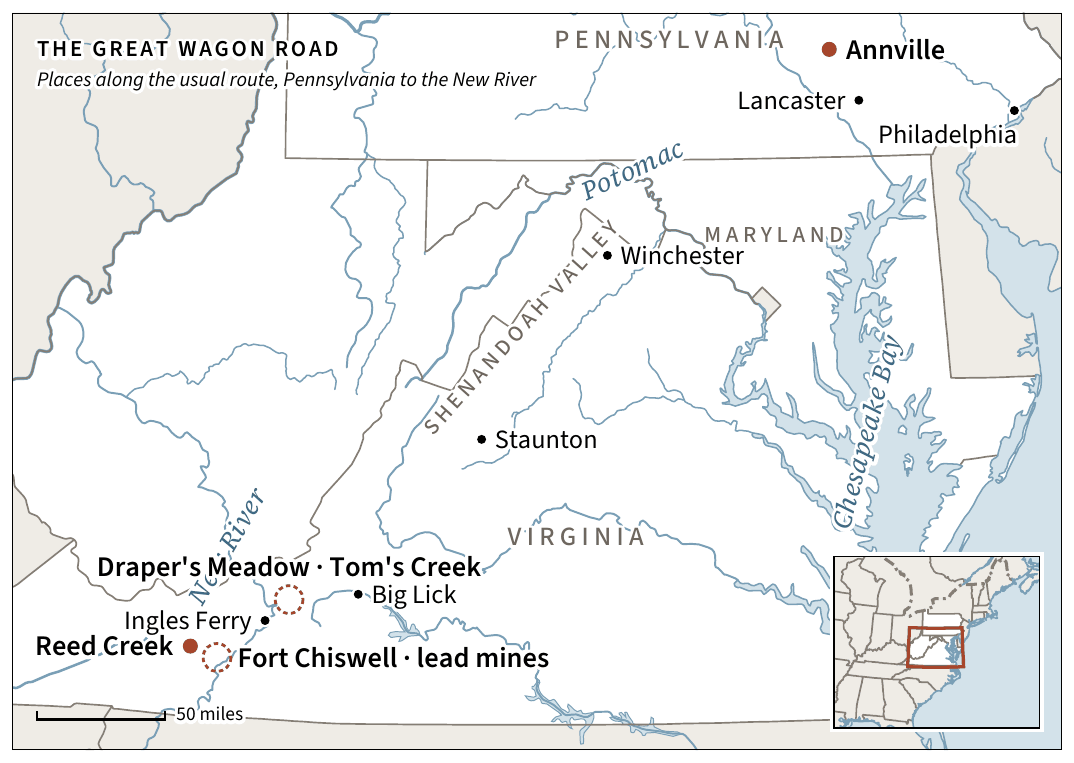
Map of the Great Wagon Road from Philadelphia and Annville through the Shenandoah Valley to Reed Creek and the New River.
The Great Wagon Road. Places along the usual route from Pennsylvania to the New River in Virginia. From chapter 5, South on the Wagon Road. Open full size
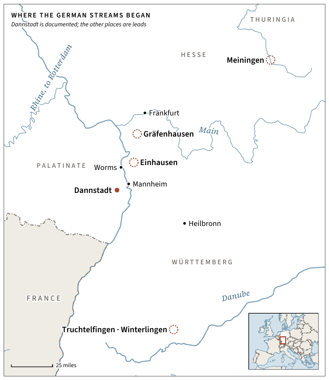
Map of the German homes of the family’s streams, with Dannstadt documented and the other places shown as leads.
German origins. The German homes of the family’s streams. Dannstadt is documented; the other places are leads. From chapter 3, Leaving the Rhine. Open full size
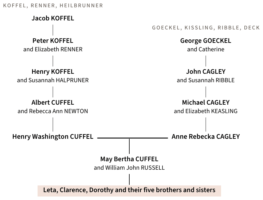
Family chart of the German streams, from Jacob Koffel and George Goeckel down to May Bertha Cuffel and William John Russell and their children.
The seven German streams. From Jacob Koffel and George Goeckel down to May Bertha Cuffel and her children. Open full size
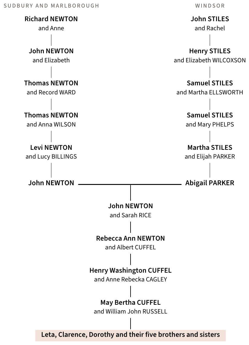
Family chart of the Newtons of Sudbury and Marlborough and the Stileses of Windsor, meeting in the marriage of John Newton and Abigail Parker in 1789.
The New England streams. The Newtons of Sudbury and Marlborough and the Stileses of Windsor, meeting in the marriage of John Newton and Abigail Parker in 1789. Open full size

Map data: Natural Earth and the US Census Bureau, both in the public domain. The charts use the book’s family tree, which is still being checked.